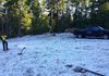
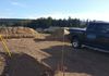
Center line layout for road construction


Our Services
Legal Surveys & Statutory Plans for Land Title Registration

Subdivisions, Postings , Stratas, Leases, Statutory Right of Ways, Easements, Covenants, Accretions, Natural Boundary Adjustments and Crown Land.
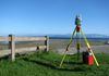
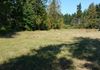
Property Boundary Surveys

When you need to know where property boundaries are (for whatever reason), we can mark the boundary lines, giving you a clear understanding of where they are on the ground.
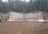
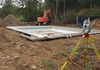
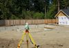
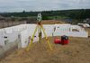
Construction Surveys & Plans

We provide the following surveys & plans related to construction:
- Topographic site surveys
- Layout for new house/building construction.
- Survey of as-builts
BC Land Surveyor's Certificate of Location

If you've been asked to provide BC Land Surveyor's Certificate of Location either for mortgage purposes by your bank or for building inspection purposes by your location government, we can provide the survey and plan needed.
Local Government Regulatory Surveys & Plans

Whenever there is a new house, structure, workshop etc.. built on your land, the local government with jurisdiction over your lot, may require surveys and plans certified by a British Columbia Land Surveyor prior to or after construction. These surveys and plans may include:
- Proposed site plans certifying the positions and heights of proposed buildings in relation to the lot boundaries and natural features like watercourses, hazardous lands, environmental protected areas and natural boundaries. These plans are general used for design, building permit and development permit purposes.
- BC Land Surveyor Certificate of Location Plans, certifying the location of features listed above. The survey and plan are done after construction has started (usually after the foundation construction stage). These plans are needed to fulfill the building permit or development permit requirements.
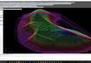
3d Laser scanning

Included in our inventory of leading edge geomatics technology is Leica MS 50 Multistation survey instrument. It allows us to capture 3d point clouds of physical features of buildings, roads infrastructure, topography, etc.. This 3d information can be used for future design purposes or is great for vary accurate stock piles volume calculations.
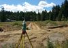
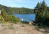
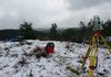
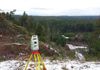
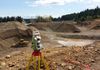
Engineering Surveys

We can provide surveys throughout the life cycle of project, from initial topographic site surveys to layout for constructing infrastructure or the final survey of as-builts. We also have the ability, through the use our 3d scanner, to provide highly detailed 3d points clouds and surface models of irregular shaped features, where the use of regular surveying instruments is no possible.
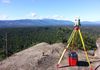
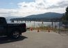
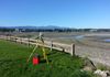
Georeferencing Surveys

Through the use of our Spectra Precision SP 80 (multi-constellation Global Navigation Satellite System (GNSS) receivers) we can provide centimeter level accuracy in determining where on the earth a feature is and how high it is above sea level.